Table of Contents

Tropical Storm John made its second landfall on Mexico’s Pacific coast on Friday, after earlier striking as a Category 3 hurricane. With sustained gusts of 45 mph, the storm struck near Tizupan in the state of Michoacan before weakening and then strengthening again.
Harrowing scenes from Acapulco, Mexico. Although much of the attention has been on #HurricaneHelene, there have been at least 8 deaths due to #HurricaneJohn hitting Mexico. #John#Helene#Floodingpic.twitter.com/4g3rjyhXFh
— Dylan Raines (@RainesOfEarth) September 27, 2024
Severe Impact on Acapulco
Authorities in Acapulco requested assistance from anybody possessing a boat in order to address the extensive flooding that resulted from the hurricane. On Monday, September 23, John had first touched down close to Punta Maldonado in winds of 105 knots. Merely 100 miles to the west of that region, in Acapulco, there was severe floods and infrastructural damage.
Destruction in Michoacan
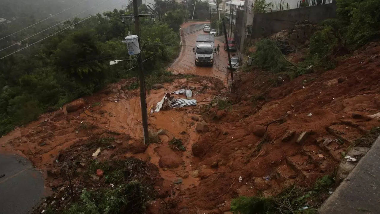
The hurricane severely damaged Mexico's Pacific coast when it made its second impact. Roads were blocked by mudslides, trees were uprooted, and tin roofs were torn off of houses. The storm intensified over the Pacific Ocean before weakening as it went onshore. Before making landfall close to Manzanillo on Thursday, it had once more risen to hurricane strength.
Satellite Tracking and Predictions
John's route was predicted by forecasters using satellite data, but they had trouble following its direction and intensity. The storm surprised forecasters by strengthening quickly—in only eighteen hours, it went from a tropical storm to a Category 3 hurricane. Estimates based on satellite data showed significant rainfall, with some regions recording up to 36 inches over the course of four days. The absence of rain gauges in the area made it more difficult to assess the storm's impact in real time.
Historical Context
Just two previous significant storms have made landfall within 150 miles of John's first hit, according to NOAA records. Hurricanes Pauline in 1997 and Otis in 2023 were those storms. Normally, hurricanes in this area stay offshore, so forecasters were unprepared for John's sudden strengthening and impact.
Forecast and Ongoing Efforts
Forecasters predicted that on Friday, John will keep heading inland, bringing further rain and possibly floods to the area. Because the storm's leftovers may cause further damage in rural areas, emergency responders and local authorities are still on high alert.

